I want to be there.
 (click for slightly larger version)
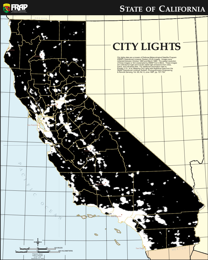
“City lights data are a mosaic of Defense Meteorological Satellite Program (DMSP) Operational Linescan System (OLS) images. These images were collected at night (10/1994-3/1995) and include visible light emissions from cities, towns, and industrial sites.”
[Full version available in the excellent FRAP Maps collection from the CA Department of Forestry and Fire Protection.]